How to Read the Houston Flood Zone Map Before You Buy or Rent
A step-by-step guide to the tools that actually work for Harris County, what the zone labels mean for your insurance costs, and where the official maps have dangerous gaps.
How to Read the Houston Flood Zone Map Before You Buy or Rent
A step-by-step guide to the tools that actually work for Harris County, what the zone labels mean for your insurance costs, and where the official maps have dangerous gaps.
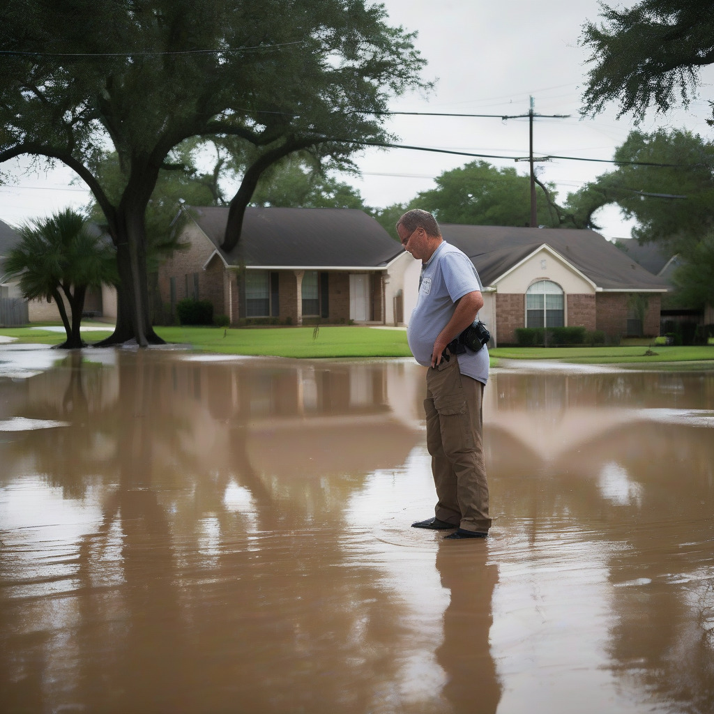
Before you look up a single address, understand this: roughly 75 percent of the structures that flooded during Hurricane Harvey in 2017 were outside the 100-year floodplain, according to post-storm analyses by Harris County and Rice University’s Kinder Institute. If you treat a flood zone map as a pass/fail verdict on whether a Houston property is safe to buy or rent, the map will lie to you. Not because the data is fraudulent, but because it was never designed to answer that question on its own.
That doesn’t mean you skip the map. It means you use two specific tools, understand what each one actually measures, and know where both of them fall short. This guide walks through that process for Harris County addresses, step by step.
Why Houston Is Different From Every Other City Doing This Lookup
Harris County is almost entirely flat. A difference of six inches in a property’s ground elevation relative to its neighbor can produce a completely different flood history across a single block. Stormwater has almost nowhere to drain quickly. Bayous back up. Street drainage overtops. The topography is so subtle that the lines on a flood zone map — drawn to the accuracy of their underlying survey data — can be meaningful or meaningless depending on which survey year underpins that specific panel. Two houses on the same street, same block, same apparent elevation. One flooded. One didn’t. That’s not an anomaly here. That’s Tuesday.
Add the region’s reservoir infrastructure, an expanding urban footprint that keeps increasing impervious surface, and the fact that NOAA’s 2018 Atlas-14 update significantly revised storm rainfall estimates for Texas — estimates FEMA hasn’t yet incorporated into many Harris County flood panels. The map reflects a specific moment in time, not current conditions.
Step 1: Start With the Harris County FEMT, Not the Federal Map
Before you open the federal flood map, go to the Harris County Flood Education Mapping Tool at harriscountyfemt.org. This is the most useful starting point for Houston-area research because it layers locally generated data over FEMA information in ways the federal map can’t replicate.
FEMT adds three things the federal map doesn’t have.
Harvey inundation depth estimates show, by parcel, how deep the water was at a specific address during the 2017 flood. This is the closest thing to a ground-truth check available at the address level, and in Houston, that matters more than any statistical model.
Repetitive loss property locations identify structures that have received two or more NFIP flood insurance claim payments of $1,000 or more within any rolling ten-year period. A property on this list has a documented flood history that no landlord or seller is required to tell you about. Unprompted, many won’t.
HCFCD drainage improvement project footprints mark active construction and planning projects across dozens of bayou corridors — useful context if a detention basin is being built upstream of the address you’re researching.
To run a lookup: go to harriscountyfemt.org and use the address search bar in the upper left. Allow the map to zoom to your parcel. Toggle the layers panel to turn on Harvey inundation, repetitive loss locations, and project footprints individually. The interface isn’t especially polished, but the data is specific and local in a way the federal tool isn’t.
Use FEMT to answer: Did this specific block actually flood in a major storm, and how deep? Use the federal map next to answer: What is the official, legally binding flood zone designation for this address? These are different questions. You need both answers.
Step 2: Cross-Reference With the FEMA Flood Map Service Center
The official, legally binding flood zone designation for any address comes from the FEMA Flood Map Service Center at msc.fema.gov. This is the designation that determines whether a federally backed mortgage triggers a mandatory flood insurance requirement.
Go to msc.fema.gov and enter the address. FEMA will return the FIRM (Flood Insurance Rate Map) panel number for that location. Click on the panel to open it, then read the zone designation from the legend.
Before you close the panel, click the “What’s New” tab at the top of the MSC interface. This is where FEMA posts pending and recently effective Letters of Map Revision. Almost every how-to guide about flood zone lookups skips this step. It has cost Houston buyers real money at closing.
A pending LOMR can change a property’s official zone designation before you close on it. Harris County’s current Digital FIRM became effective in 2019, but individual panels are updated on a rolling basis as drainage improvement projects finish. Verify the effective date of the specific panel covering your address before any transaction.
Step 3: Decode What Your Zone Label Actually Means in Houston Terms
FEMA’s zone labels sound technical but translate to real insurance costs and risk consequences.
Zone AE is the 100-year floodplain — the area with a 1 percent annual chance of flooding, with a calculated Base Flood Elevation assigned to the parcel. If you’re taking out a federally backed mortgage (FHA, VA, conventional loans sold to Fannie Mae or Freddie Mac), flood insurance is required. The lender will enforce it. Zone AE covers large portions of Meyerland along Brays Bayou, sections of Kingwood near Lake Houston, stretches of the Heights along White Oak Bayou, and portions of Friendswood on the Harris County side. These aren’t fringe neighborhoods. They’re some of Houston’s most actively transacted residential addresses.
Zone X (shaded), sometimes labeled Zone X500, falls between the 100-year and 500-year floodplains. No mandatory purchase requirement, which means many buyers and renters skip flood insurance entirely. In Houston’s context, that’s a mistake worth spelling out: the absence of a mandate is not a risk assessment. It’s a regulatory threshold.
Zone X (unshaded) is FEMA’s minimal-risk designation. The next section explains at length why this label is particularly dangerous in Houston. Short version: it means no mandatory insurance purchase and a statistical model predicting low risk. It does not mean no risk. Thousands of Kingwood homes mapped as unshaded X flooded catastrophically in 2017.
Zone AO applies to sheet-flow flooding — water moving across flat land rather than rising from a defined channel. Depths typically run one to three feet, expressed as a depth designation rather than an elevation. Less common inside the city proper, but it appears in some low-lying areas with overland flow patterns.
Zone VE applies to coastal areas subject to wave action — Bolivar Peninsula, portions of Galveston Island, areas near the bay shoreline around La Marque. VE carries the highest flood insurance premiums of any zone, and for good reason: it combines high inundation probability with structural damage from wave force.
Step 4: Understand Why “Zone X” Does Not Mean Safe in Houston
Kingwood is the clearest illustration available. The large master-planned community in northeast Harris County along the San Jacinto River was marketed for decades as a flood-safe environment — higher ground, careful drainage design, premium development. Much of Kingwood was mapped as Zone X unshaded, meaning FEMA rated it at minimal flood risk. Residents believed it. Sellers said it. Agents repeated it.
During Harvey, the San Jacinto River rose, Lake Houston filled, and authorities released water from the Lake Houston dam. Thousands of Kingwood homes flooded — entire subdivisions including Kingwood Lakes, Kings Forest, and Elm Grove, places that had never flooded in their residents’ lifetimes, now under several feet of water.
FEMA flood zone designations are built around riverine flooding models and rainfall-to-runoff statistical analysis. They don’t systematically account for reservoir behavior or the risk of dam and gate releases. The potential for controlled or emergency releases from Addicks, Barker, and Lake Houston is not reflected in zone designations for areas downstream. Buyers who relied on Zone X as a safety signal in Kingwood had no regulatory tool warning them otherwise. A designation functioning as reassurance for a risk it was never designed to measure — that’s a real problem with how these maps get used, and nobody in the transaction chain is required to flag it.
The Atlas-14 problem runs parallel to this. In 2018, NOAA published updated rainfall frequency estimates for Texas, significantly raising the statistical rainfall amounts associated with 100-year and 500-year storm events. What used to be modeled as a 100-year storm now occurs at lower rainfall totals than the old maps assumed. Many Harris County FIRM panels were drawn using pre-Atlas-14 data and haven’t been updated. The 100-year floodplain line on your map may be drawn narrower than the actual risk warrants. If recalculated under Atlas-14 assumptions, the real area of 100-year risk would extend further outward.
East Downtown and Second Ward illustrate this directly. Some panels covering these neighborhoods predate both Harvey and Atlas-14 and were last substantively revised before either event produced data that would push the AE zone boundaries outward. Zone X means no mandatory insurance purchase. It does not mean no flood risk. In Houston, for reasons specific to this region’s topography, reservoir infrastructure, and map vintage, that distinction has cost people their homes.
Step 5: Check Whether Your Area Is Currently Being Remapped
Letters of Map Revision (LOMRs) are formal changes to the FIRM that FEMA issues when conditions on the ground change — typically because a flood control project has been completed. Harris County’s 2018 flood bond authorized $2.5 billion in drainage improvements, and those projects are finishing on a rolling basis across multiple watersheds. When HCFCD submits supporting engineering to FEMA after a project completes, a LOMR process begins. During that process — which can take months — the official zone designation on the map hasn’t changed yet. But it will.
If you buy a Zone X property with a LOMR pending that will reclassify it to Zone AE, you’ll face a mandatory flood insurance requirement that wasn’t on the map when you made your offer. Your lender will discover this. It can disrupt a closing or significantly change the purchase economics. Agents working Meyerland deals have watched closings fall apart over exactly this.
Four active remapping corridors where Houston buyers should specifically check:
Brays Bayou (Meyerland, Westbury, Braeswood Place) — the most extensively engineered bayou channel in the county. HCFCD has completed multiple channel modifications that have already produced LOMRs, with additional bond projects in progress or recently finished.
Hunting Bayou (Kashmere Gardens, Trinity/Houston Gardens) — bond-funded improvements affect lower-income northeast Houston neighborhoods where residents are least likely to have access to professional flood zone guidance. Worth noting.
Greens Bayou (Acres Homes, Aldine) — spans both city of Houston and unincorporated Harris County.
Spring Branch Creek (Spring Branch, Memorial area) — channel and detention work affects some of Houston’s most actively transacted residential real estate.
To check the status of any active remapping: run the “What’s New” check on the FEMA MSC panel as described in Step 2, then cross-reference with the HCFCD Project Tracker, which allows searches by watershed. Verify specific LOMR case numbers and current effective dates directly at MSC before any transaction.
Step 6: Ask for the Elevation Certificate and Know What to Do With It
An Elevation Certificate is a standardized FEMA form completed by a licensed land surveyor that documents a structure’s elevation relative to its Base Flood Elevation. For any Zone AE property, an EC is required to obtain an NFIP flood insurance policy. It’s also what most directly determines what your flood insurance premium will be.
If the structure sits well above its BFE, the premium is substantially lower than if it sits at or below BFE. The difference isn’t marginal — it can be thousands of dollars annually. A buyer who waits until after the offer is accepted to find out the house sits below BFE is making a financial decision they can’t fully price. That’s a bad position.
For any Zone AE property, ask the seller or listing agent whether an elevation certificate exists. Many do. If the property has ever carried an NFIP policy, the EC may be on file with the city of Houston’s floodplain management office or with Harris County’s floodplain administrator. Retrieving an existing one costs nothing. If none exists, a licensed surveyor can prepare one — get current pricing from local surveying firms before budgeting for it.
Once you have the EC, take it to a flood insurance agent who specifically writes NFIP policies and understands Risk Rating 2.0. Get a premium estimate before you close.
Step 7: Understand the Insurance Exposure Before You Commit
FEMA’s Risk Rating 2.0 system, effective April 2022, changed how flood insurance premiums are calculated. Under the old system, premiums were set largely by zone and BFE — two houses in the same zone paid nearly identical rates. Under Risk Rating 2.0, FEMA incorporates the property’s distance from a water source, the type of flooding it’s susceptible to, the cost to rebuild, and specific elevation characteristics. Two Zone AE houses on the same Meyerland block now carry different premiums because their individual risk profiles differ in ways the old system didn’t capture.
A property may carry a low current NFIP premium because the previous owner’s policy was grandfathered under older rates. That grandfathering can phase out if a policy lapses or is transferred without maintaining continuity. A buyer who assumes they’ll simply continue the seller’s policy at the seller’s rate needs written confirmation from the insurer about the actual rate they’ll face after transfer. Ask to see the current declarations page. Then ask the insurer directly about the rate trajectory under Risk Rating 2.0.
Private flood insurance is a real option — many lenders now accept private policies in place of NFIP, and for some risk profiles (higher-elevation Zone AE properties, or Zone X properties where a buyer wants voluntary coverage), private carriers may offer lower premiums or higher coverage limits. An independent agent who writes in the Texas market is worth a conversation before defaulting to NFIP.
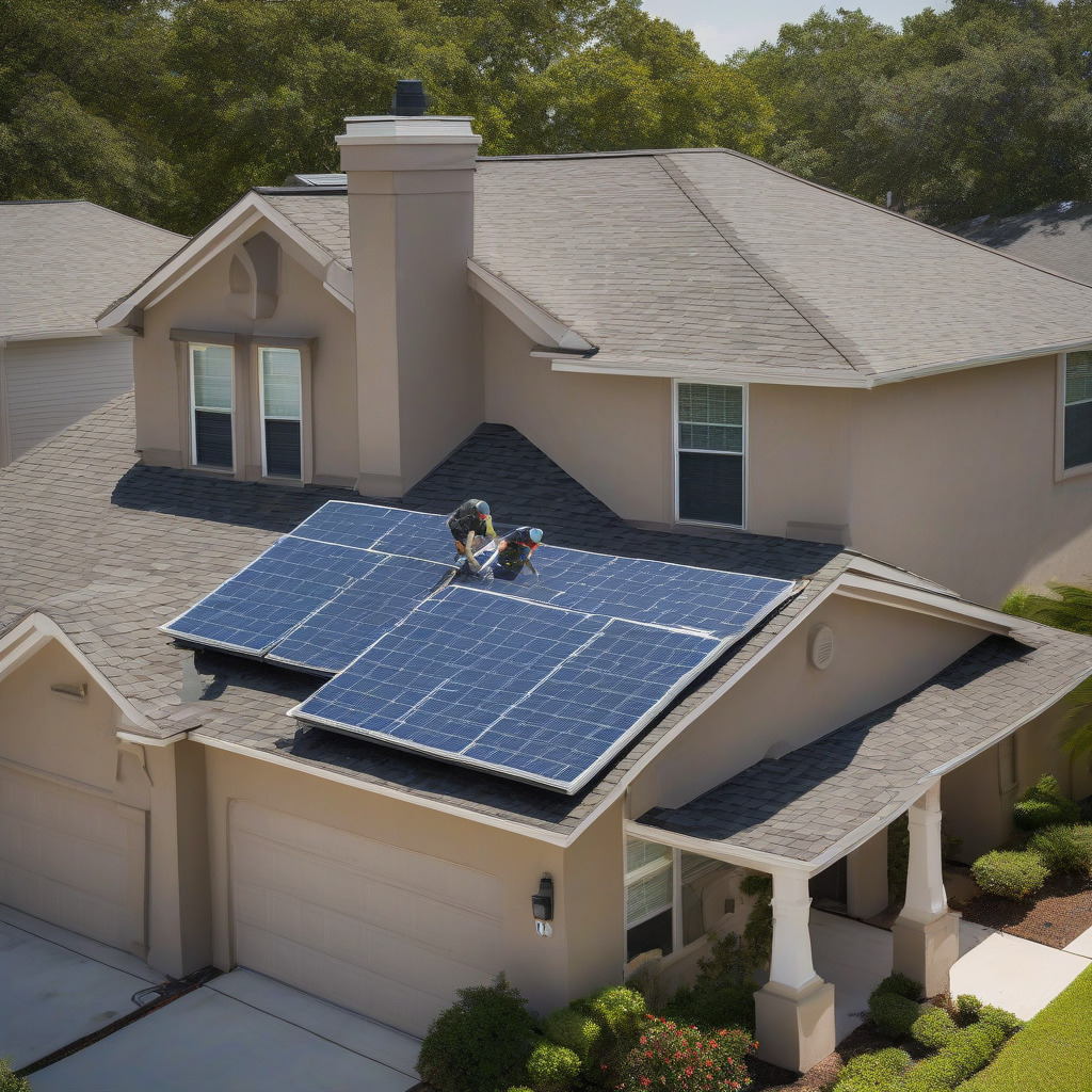
Harris County Chapter 19 is the county’s local floodplain management ordinance, and it has teeth that can surprise buyers. The freeboard rule requires new construction and substantial improvements in the floodplain to be elevated above BFE by a margin exceeding FEMA’s minimum — verify the current standard with Harris County’s floodplain administrator, since the requirement was tightened after Harvey. The 50 percent substantial-improvement threshold means that if a renovation equals or exceeds 50 percent of the structure’s pre-improvement market value, the whole structure must be brought into compliance with current floodplain rules. Meyerland homeowners repairing post-flood damage have been hit with this: a foundation elevation project that was never in the budget became mandatory because nobody ran the math before the contractor broke ground. Run the math first. For more research like this, see our home and property coverage on Houston real estate, insurance, and neighborhood conditions.
Step 8: What Renters Need to Know and Won’t Be Told
Most flood zone guidance is written entirely for buyers. Renters make up a substantial share of Houston’s housing market, particularly in the inner loop and the Heights, and they’re largely left without equivalent information.
Texas law does not require landlords to disclose flood history or flood zone status to prospective tenants. No statutory obligation to tell you the apartment you’re touring flooded during Harvey, that the building has received multiple NFIP claims, or that the property sits in Zone AE. That information exists in public records. Nobody will hand it to you.
Run the same FEMT and FEMA MSC lookups described above for any address you’re seriously considering. FEMT’s repetitive-loss layer is particularly useful here — a property flagged as a repetitive-loss structure tells you NFIP has paid claims on it more than once. That’s a documented flood history. Ask the landlord directly, in writing, whether the unit or building has flooded. Get the answer in writing. A landlord who won’t answer a direct question about documented flood history is telling you something important about how the relationship will go if there’s ever a problem.
Renters insurance with a flood endorsement, or a separate NFIP contents-only policy, is worth pricing for any Zone AE or Harvey-inundated address. NFIP contents-only coverage is available at the unit level under Risk Rating 2.0. Renters whose units flooded during Harvey and had no flood coverage found out the hard way that standard renters insurance doesn’t cover flood damage to personal property. It covers theft and fire. Not flood. That’s it.
Pre-Offer Checklist for Houston Buyers and Renters
Before you sign anything, work through this list for the specific address:
-
Run the FEMT lookup at harriscountyfemt.org. Note whether the parcel shows Harvey inundation depth, whether it appears on the repetitive-loss layer, and whether it falls within an active HCFCD project footprint.
-
Run the FEMA MSC lookup at msc.fema.gov. Record the FIRM panel number, the zone designation, and the panel’s effective date.
-
Check the “What’s New” tab on the FEMA MSC panel for pending or recently effective LOMRs that could change the zone designation before or after closing.
-
Identify the watershed (Brays, Hunting, Greens, Spring Branch, Buffalo, White Oak, etc.) and search the HCFCD Project Tracker for active or completed projects affecting that corridor.
-
Request the elevation certificate from the seller or listing agent. If none exists, check with the city of Houston or Harris County floodplain administrator before commissioning a new one. For Zone AE properties, don’t make an offer without a plan to obtain this document.
-
Get a flood insurance premium estimate from an agent who writes NFIP policies and understands Risk Rating 2.0 before the offer, not after inspection. For Zone AE properties, ask specifically whether the current policy carries any grandfathered rate and what the actual Risk Rating 2.0 premium would be.
-
Ask whether private flood insurance has been quoted. For some Zone AE properties and for buyers in Harvey-inundated Zone X areas who want voluntary coverage, private carriers may offer better terms.
-
If the property is Zone X and FEMT shows Harvey inundation, or it sits downstream of Addicks, Barker, or Lake Houston dam, price flood insurance anyway. The regulatory category doesn’t reflect the actual risk profile for a meaningful portion of Houston’s residential parcels.
-
For renters: Ask the landlord in writing about flood history. Run the same FEMT and FEMA MSC lookups. Check the repetitive-loss layer. Get a quote for contents-only NFIP coverage or a private flood endorsement.
-
For any Zone AE renovation, particularly in Meyerland, Braeswood Place, or other neighborhoods with established Harvey flood histories, calculate whether your planned improvements approach the Chapter 19 substantial-improvement threshold before you finalize a budget. Verify the current freeboard and threshold requirements with Harris County’s floodplain administrator before breaking ground.
The flood zone map is a tool with specific limitations in a city where those limitations kill deals, erase savings, and occasionally destroy homes. Harris County’s land is flat enough that a single foot of grade difference can separate a dry house from a flooded one. The maps themselves were drawn on rainfall assumptions NOAA has since revised significantly upward. Kingwood happened. Meyerland happened. Neighborhoods nobody thought to worry about flooded. Use the tools in the order described here, understand what each one measures, and don’t mistake a zone designation for a guarantee. In Houston, it has never been one.