How Houston's Subsidence Problem Affects Your Foundation and Insurance
Harris County's ground is measurably lower than it was a generation ago. The ZIP codes still sinking fastest face a compounding threat that most homeowners—and many real estate agents—don't fully u…
How Houston’s Subsidence Problem Affects Your Foundation and Insurance
Harris County’s ground is measurably lower than it was a generation ago. The ZIP codes still sinking fastest face a compounding threat that most homeowners—and many real estate agents—don’t fully understand.
The Third Repair in 15 Years
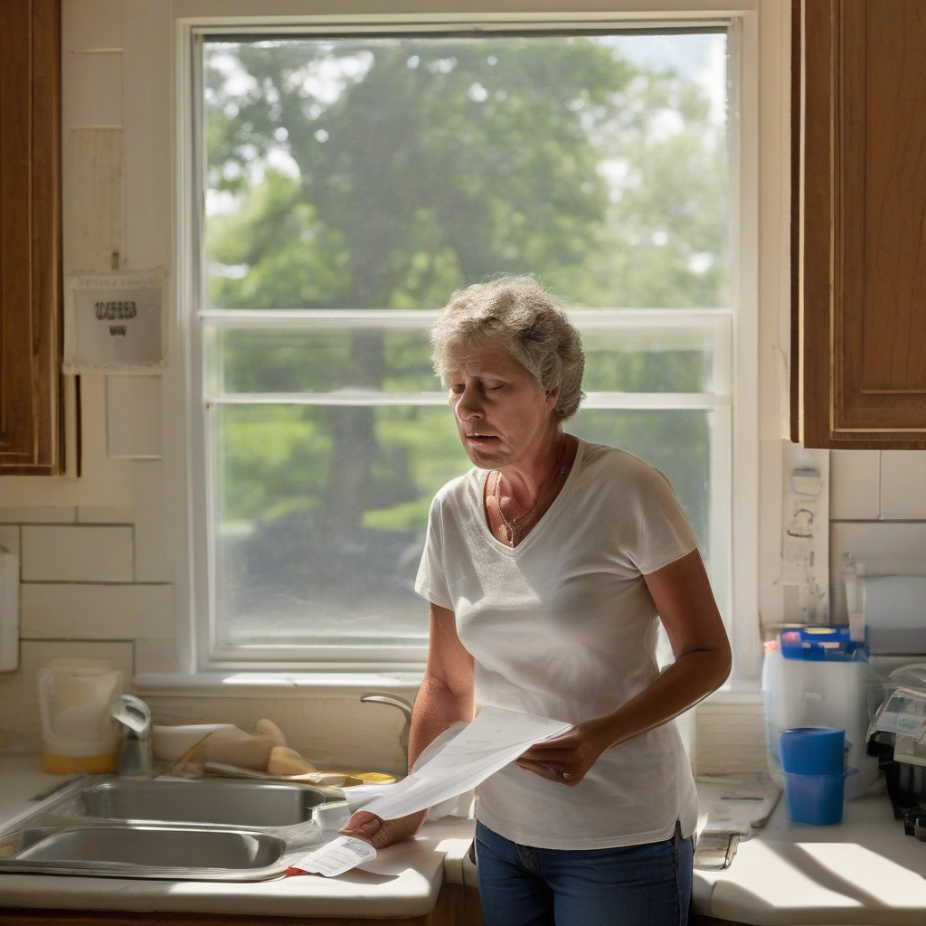
Sandra Morales bought her brick ranch in the 77449 ZIP code in 2006. That’s the Katy/Cinco Ranch corridor west of Beltway 8. She replaced the original pressed-concrete piers in 2009 after interior doors started sticking and a crack opened along her back bedroom wall. She had the foundation re-leveled in 2017 when the master bath threshold tilted enough to collect standing water after showers. Last spring, her structural engineer told her she needed a third round.
“I kept asking him what I was doing wrong,” Morales said. “He finally sat me down and said, ‘Sandra, it’s not you. The ground itself is going down.’”
Her engineer is correct. In Harris County’s highest-subsidence ZIP codes, foundation repair isn’t a permanent solution to a one-time construction failure. It’s increasingly a maintenance cycle imposed on homeowners by a geological and regulatory problem that operates far beneath their slabs and almost entirely outside their control. Most Houston homeowners never get a clear explanation of that distinction. This article is an attempt to provide one.
What Subsidence Actually Is, and Why Houston Has It Worse Than Almost Anywhere
Ground subsidence in the Houston area differs fundamentally from the seasonal clay movement that causes the minor cracking virtually every Houston homeowner notices and mostly learns to ignore. If you’ve owned a house here longer than five years, you know the drill: a hairline crack appears near a door frame in August, you call someone, they tell you it’s just the clay, you try to believe them.
Here’s how the mechanics work. Harris County sits atop two major aquifer systems: the Chicot and the Evangeline. Their water-bearing sands and gravels are interbedded with thick layers of Beaumont Clay, a compressible formation that underlies most of the Texas Gulf Coast. For roughly a century, municipal water suppliers, industrial facilities, and private users pumped enormous volumes of groundwater out of those aquifers. As water pressure within the aquifer decreased, the clay layers—no longer buoyed by that pressure—compressed. Permanently. That compression is measured not in millimeters but in feet. Harris County has lost as much as 10 to 12 feet of land surface elevation in its most severely affected corridor, the Ship Channel–Pasadena–Baytown stretch, since systematic measurement began in the 1920s.
Twelve feet. Gone permanently. That number stops me every time.
This is categorically different from the clay shrink-swell that is the background noise of Houston homeownership. Seasonal shrink-swell is moisture-driven: soil contracts in dry summers and expands after wet periods. Its effects on a slab are typically measured in fractions of an inch and partially reverse themselves. Aquifer-driven subsidence is compaction of the deep clay column itself. It doesn’t reverse. It doesn’t recover when rainfall returns.
Houston’s particular vulnerability comes from three converging facts. The Beaumont Clay is unusually thick here—in some areas extending hundreds of feet below grade—giving it enormous compressive capacity when depressurized. The region’s reliance on groundwater was, for most of the 20th century, essentially unlimited. And virtually all residential construction uses slab-on-grade foundations, which means the structure sits directly on the soil surface with no pier-and-beam buffer. When the soil column moves, the slab moves with it.
Which ZIP Codes Are Sinking Fastest Right Now
The Harris-Galveston Subsidence District (HGSD) maintains a network of extensometer stations and GPS benchmarks across the county. They produce the most granular public subsidence data available for any major American city. Their monitoring reports and interactive subsidence maps, available at hgsubsidence.org, track both cumulative historical loss and current active rates in millimeters per year.
The geographic story those numbers tell has shifted significantly over the past two decades, and the shift matters to anyone making a real estate decision today.
The southeast corridor—historically the worst—has slowed measurably. Pasadena (77502, 77506), Baytown (77520, 77521), and Deer Park (77536) carry the highest cumulative elevation loss in the county. Mandatory conversion of large municipal and industrial groundwater users to surface water supply—drawing from Lake Houston and the Trinity River system—has reduced active subsidence rates in this corridor. The pattern is clear: when you stop pumping groundwater in volume, the subsidence rate declines. That’s actually encouraging, even if it took decades and a lot of damage to get there.
The active risk has moved northwest. Katy area ZIP codes, particularly 77449 and 77450, and Jersey Village (77040) currently show among the highest ongoing subsidence rates in the county per HGSD monitoring. The reason is straightforward: large portions of these communities, including newer master-planned developments, still draw from groundwater. The exemptions built into HGSD’s permitting structure mean that aggregate residential groundwater demand in fast-growing northwest Harris County hasn’t been fully addressed by the surface-water conversion mandates that reduced industrial and municipal pumping elsewhere. Residential users below a certain volume threshold aren’t required to hold permits.
| ZIP Code | Community | Cumulative Historical Loss | Current Active Rate | Primary Driver |
|---|---|---|---|---|
| 77502, 77506 | Pasadena | High cumulative | Slowing (significant rate reduction since surface water conversion) | Industrial/municipal conversion underway |
| 77520, 77521 | Baytown | High cumulative | Slowing | Surface water conversion |
| 77536 | Deer Park | High cumulative | Slowing | Surface water conversion |
| 77449, 77450 | Katy | Moderate cumulative | Active, ongoing—among highest current county rates per HGSD monitoring | Residential groundwater, growth |
| 77040 | Jersey Village | Moderate cumulative | Active, ongoing—elevated per HGSD monitoring | Mixed residential/commercial groundwater |
Note: Rates vary significantly by monitoring station within a ZIP code. Current millimeter-per-year figures for specific stations are published in HGSD’s annual monitoring reports.
To look up your specific address, go to hgsubsidence.org and navigate to the “Subsidence Maps” or “Interactive Map” section. The map displays color-coded rate zones shaded from green (minimal active subsidence) through yellow and orange to red (highest active rates). Enter your address or navigate to your area. You can also identify the nearest extensometer or GPS monitoring station and pull that station’s historical record, which shows the trend over time. That trend line—whether subsidence is accelerating, holding steady, or slowing—is often more useful than a single current number. I’d start there before looking at anything else.
The Feedback Loop That Makes Flooding Worse at the Same Time
The foundation damage story is serious on its own. The flooding piece compounds it in ways that FEMA maps and most flood zone disclosures don’t communicate—and this is the part that tends to catch people off guard.
When land subsides, everything built on that land subsides with it, including the drainage infrastructure whose performance depends entirely on gravity. Storm sewer outfalls designed to drain by gravity to a bayou or detention basin at a certain elevation now sit closer to that receiving water body’s flood stage. The freeboard margin—the buffer between normal operations and failure—quietly shrinks without any construction change occurring and without any formal record being updated.
Detention basin capacity is partly a function of the differential between the basin’s designed storage elevation and the surrounding land surface. As land drops, effective capacity relative to the drainage area it serves changes. The levees and spillways were engineered at one set of relative elevations and now operate at another.
Brays Bayou, whose watershed spans the Texas Medical Center and extends southwest through Meyerland, runs through terrain that has lost significant elevation since the bayou’s channel geometry was first established. The Army Corps of Engineers and Harris County Flood Control District have undertaken major channel improvements to Brays over the past two decades. That work has real value—but some of it is offsetting capacity loss rather than purely adding new protection. Worth keeping in mind the next time you hear about a completed flood project in your area.
A property’s FEMA flood zone designation doesn’t account for subsidence. A home accurately mapped as Zone X (minimal flood hazard) in 1990 that has since experienced measurable subsidence may now have real-world flood exposure closer to Zone AE. Its designation hasn’t changed. Neither has the flood insurance recommendation attached to it. The gap between map and reality is largest in the areas with the highest active subsidence rates.
Harris County went through a major FEMA map revision following Hurricane Harvey, with some areas seeing Base Flood Elevation increases of two to four feet. Even those updated maps are a static snapshot. They don’t account for the subsidence occurring after the ink dries.
What Your Homeowner’s Policy Won’t Cover, and What the Seller Disclosure Form Requires
Texas homeowner’s policies—whether HO-A (basic named perils), HO-B (broader named perils), or HO-C (open perils)—contain earth movement exclusions. The language is explicit. Settling, cracking, shrinking, bulging, or expansion of the earth, and subsidence of land, are not covered causes of loss. This exclusion applies regardless of the severity of the damage and regardless of whether earth movement is triggered by a covered peril like flooding. If your slab cracks because the ground beneath it has compacted, your standard homeowner’s carrier won’t pay for it. Full stop.
Standalone earth movement endorsements do exist. They’re issued almost exclusively through surplus lines carriers—Lloyd’s of London syndicates are the most common vehicle—and they’re rarely offered to Houston homeowners by retail agents without a specific request. Homeowners in active-subsidence ZIP codes who have had foundation repairs, or who are purchasing near bayous, should ask their agent directly whether a surplus lines earth movement endorsement is available and what the underwriting requirements look like. Some underwriters won’t bind coverage in the highest-rate zones at all. Others will bind with a significant waiting period—a provision designed to prevent homeowners from purchasing coverage after damage is already underway.
FEMA’s National Flood Insurance Program covers inundation: water that enters your structure from outside due to flooding. It doesn’t cover land movement or the structural damage that results from it. Title insurance covers legal ownership and liens. It covers nothing about the physical condition of the land.
The seller disclosure obligation is where the most immediate legal exposure sits. Texas TREC’s Seller’s Disclosure Notice (form OP-H), required for most residential sales in Texas, includes Question 7 under the physical condition section. The question asks whether the seller has knowledge of any settling, slippage, or movement of the foundation or other structural components. A seller in 77449 or 77040 who has had foundation piers installed, who has had a structural engineer evaluate the slab, or who has actively managed foundation movement has knowledge of settling and movement. That knowledge triggers a disclosure obligation. The disclosure doesn’t necessarily kill a sale—buyers purchase properties with disclosed foundation histories all the time—but failing to disclose it is a misrepresentation that can form the basis of a post-closing legal claim.
Real estate attorneys handling post-closing disputes in Harris County report that foundation disclosure cases are among the most common they see. The pattern recurs: buyer purchases home, discovers foundation movement within a year or two, reviews the seller’s disclosure, finds prior repairs weren’t disclosed, consults an attorney. In active-subsidence ZIP codes where foundation repair is a recurring maintenance task, sellers need to understand that each repair episode is a disclosure event for the next transaction. Every single one.
What the Harris-Galveston Subsidence District Is Actually Doing
The HGSD was created by the Texas Legislature in 1975 specifically to address land subsidence in Harris and Galveston counties. Its mechanism is a permitting system. Large-volume groundwater users must obtain permits, and those permits set conditions and, increasingly, require conversion to surface water supply.
The phased conversion program is the district’s primary policy tool. Earlier phases compelled large municipal and industrial users—cities, utilities, major industrial facilities along the Ship Channel—to replace substantial fractions of their groundwater demand with surface water. The results in the southeast corridor show that the approach works. Subsidence rates in Pasadena and Baytown declined substantially following surface water conversion. The rate change is reversible, even if cumulative loss can’t be recovered.
Phase 3 of the regulatory plan sets higher conversion thresholds with deadlines running into the mid-2020s. The district’s regulatory plan underwent review in 2023–2024 and addresses ongoing compliance requirements and targets for further groundwater reduction. The question critics argue hasn’t been adequately addressed: how to enforce reduction targets against the residential and light commercial users in high-growth northwest Harris County who collectively pump significant volumes below the individual permit threshold.
That exemption structure is a known gap. HGSD permits are required when groundwater withdrawals exceed a certain annual volume. Individual residential wells often fall below that threshold. But in a master-planned community of several thousand homes, the aggregate of those individual wells constitutes serious aquifer demand. The district has authority over large users but limited direct control over distributed residential groundwater use. The fastest-growing parts of Harris County—where new homes continue to be built on lots served by private wells or small community water systems that haven’t converted to surface water—are precisely the areas now showing the highest active subsidence rates. That’s not a coincidence.
The district’s position is that conversion mandates apply as those systems grow to permit-required scale, and that surface water infrastructure to serve those areas is being built. Some geotechnical engineers and hydrologists argue instead that the conversion thresholds are too high and too slow, and that the northwest corridor is replicating, on a compressed timeline, the same trajectory the southeast corridor followed in the mid-20th century. That’s a serious argument and it hasn’t been convincingly answered.
One thing the district has unambiguously built: a monitoring network that is among the most detailed in the world for an urban subsidence problem. The public data available through hgsubsidence.org is genuinely useful and genuinely current. That’s worth acknowledging. It doesn’t resolve the regulatory debate, but it means Houston homeowners have access to information that people dealing with similar problems in other cities simply don’t have.
Why Fixing Your Foundation Doesn’t Fix the Problem
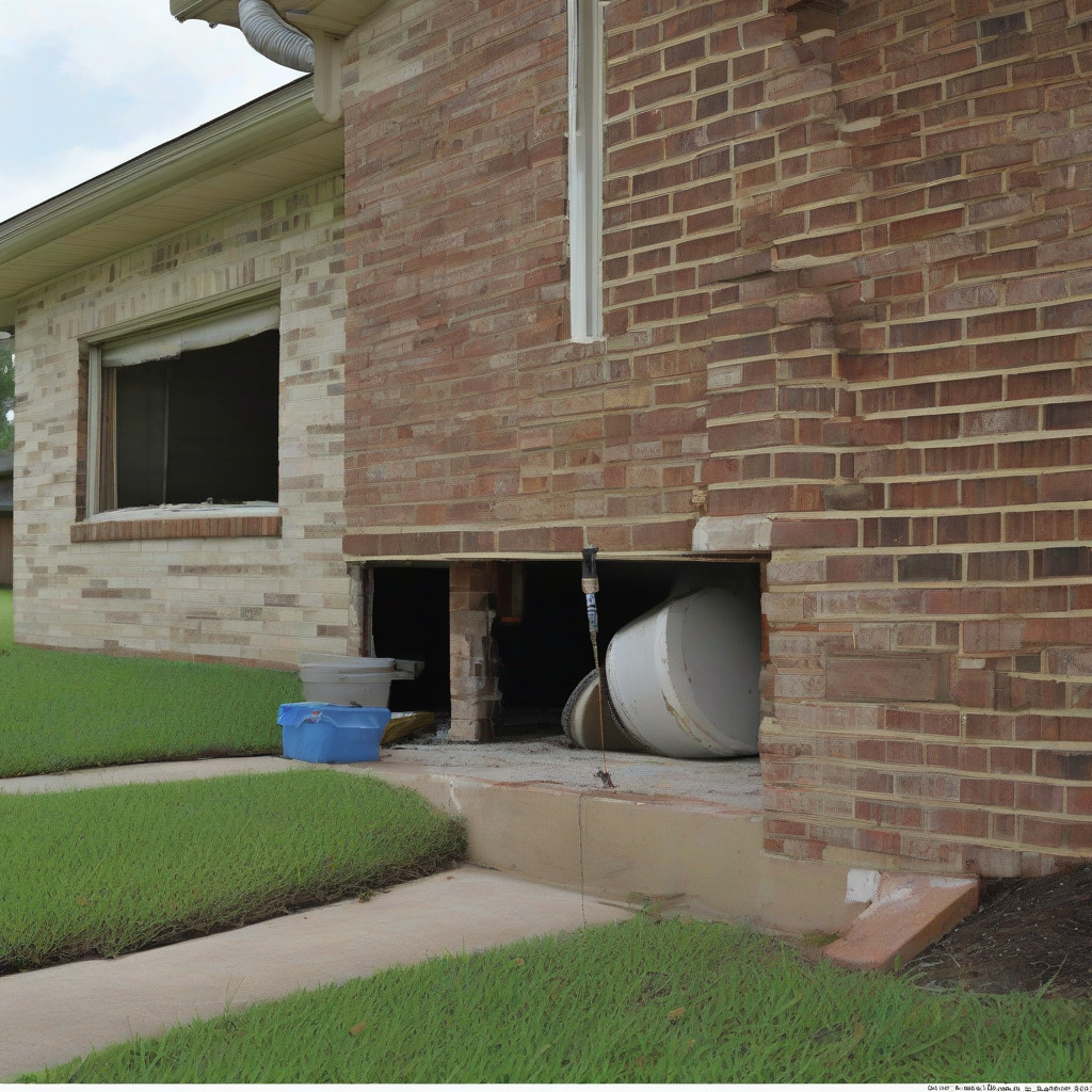
When a foundation repair contractor installs piers—pressed concrete cylinders driven to refusal, steel push piers driven to load-bearing strata, or helical piers screwed into the ground—the repair corrects the current position of the slab. The contractor re-levels the structure relative to where the soil column currently sits. If the work is done competently, it works. For a while.
What it doesn’t do is stop the ongoing downward movement of the soil column itself. If the soil beneath the slab is continuing to compact—as it demonstrably is in 77449, 77450, and 77040 at measurable rates per HGSD monitoring—the slab will continue to move after the piers are installed. How quickly depends on the local subsidence rate, the soil variability beneath the specific foundation, the depth to which piers were driven, and whether differential settlement is occurring.
Differential settlement deserves particular attention. Uniform subsidence—the entire slab descending at roughly the same rate—causes less structural damage than differential settlement, where one section drops faster than another. Differential movement is common near bayous and drainage channels, where fill depth varies significantly across a property. The section of a slab sitting on eight feet of engineered fill compresses differently than the section sitting on two feet of fill above native clay. Properties near Brays Bayou, Cypress Creek, Addicks Reservoir, and similar features are particularly exposed for exactly this reason.
A forensic geotechnical inspection—distinct from the standard evaluation a foundation repair company provides—is the appropriate tool for understanding whether damage to a specific home is driven primarily by aquifer subsidence, clay shrink-swell, or some combination. The distinction matters because it affects what repair approach is appropriate, what any insurance or coverage dispute should focus on, and whether a buyer conducting pre-purchase due diligence is getting the full picture. A geotechnical engineer will typically review HGSD monitoring data for the area, examine boring logs or conduct new borings to characterize soil conditions beneath the specific structure, and assess crack patterns and settlement history to distinguish the two mechanisms. Clay shrink-swell damage tends to be somewhat seasonal and to involve characteristic crack geometries. Aquifer subsidence damage tends to be progressive and directional.
Situations that should prompt a geotechnical inspection rather than simply calling a foundation repair company: a second or third round of repairs at the same property; a purchase in 77449, 77450, or 77040 where the seller disclosure shows prior foundation work; a property with bayou or drainage channel frontage or visible fill slopes; or any situation where you need to understand whether ongoing subsidence will void a repair warranty.
Before commissioning any foundation work in a high-subsidence ZIP code, ask the engineer directly: What is the current active subsidence rate at this location per HGSD monitoring data, and does your repair recommendation account for continued movement? Any competent engineer practicing in Harris County should be able to answer that specifically. If they can’t, find someone who can.
What Homeowners in High-Risk ZIP Codes Should Do Now
Start with the HGSD map at hgsubsidence.org. Find your address, determine what color zone you’re in, and identify the nearest monitoring station. Download that station’s historical data and look at the trend over the past decade. A station showing declining rates is in better shape than one showing acceleration. Write down the numbers—you’ll need them for the conversations below.
Get your elevation certificate updated if it’s more than five years old. An elevation certificate documents your finished floor elevation relative to the Base Flood Elevation on the current FEMA map. In a subsidence zone, an older certificate may reflect an elevation your property no longer has. An updated certificate requires a licensed surveyor. If you’re in or near a Special Flood Hazard Area, this isn’t optional—it’s the only way to accurately assess your flood insurance requirement and rate.
Talk to your insurance agent about earth movement endorsements. Ask specifically: Can you access a surplus lines earth movement endorsement for this address, and which carriers are you checking? If your retail agent doesn’t work with surplus lines markets, you may need an independent broker who does. Don’t let an agent wave this off without actually running the check. Underwriting availability varies by location, but the answer should come from a real market inquiry.
If you own property in a high-subsidence zone and plan to sell, talk to your real estate attorney about your disclosure obligations before you list. If you’ve had foundation work done, received a structural evaluation, or actively managed foundation movement, Question 7 of the TREC Seller’s Disclosure Notice requires disclosure. Getting clear on this before you list protects you from post-closing claims.
Track the HGSD regulatory calendar if you own in 77449, 77450, or 77040. The district’s regulatory plan reviews are public proceedings, and their outcomes will directly affect the long-term subsidence trajectory beneath your home. HGSD board meetings are open to the public. Monitoring reports are published annually and available without charge at hgsubsidence.org.
Sandra Morales is going ahead with the third repair. Her engineer recommended steel push piers this time, driven deeper than the previous pressed-concrete work, specifically because the soil column in her part of Katy is still compressing. He was honest with her—which, by her account, wasn’t easy for either of them. The piers will correct her current situation and should hold for some years, but she’s planning to have the foundation re-evaluated every three to five years going forward. For Houston homeowners navigating these decisions, this article is part of our home and property coverage examining how local conditions affect the physical and financial health of residential real estate.
“At least now I know what I’m dealing with,” she said. “It’s not my house that’s failing. It’s the ground.”
That doesn’t make the repair bills easier to absorb. But it is the starting point for every other decision—about insurance, about disclosure, about what to monitor, about whether to stay. You can’t make good decisions about a problem you’ve misdiagnosed.
HGSD annual monitoring reports and the interactive subsidence map are public documents available at hgsubsidence.org. The TREC Seller’s Disclosure Notice (form OP-H) is available at trec.texas.gov. Homeowners with questions about specific properties should consult a licensed geotechnical engineer, a licensed surveyor for elevation certificates, and an independent insurance broker for surplus lines availability.