How to Research Flood Risk Before You Buy a House in Houston
FEMA's maps are seven years out of date. Here's how to use the Harris County tool that shows you what's actually underwater.

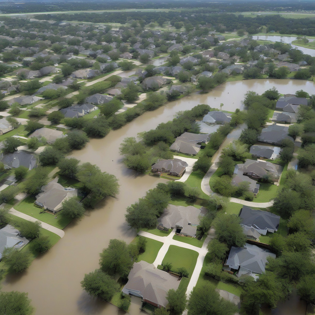
FEMA’s maps are seven years out of date. Here’s how to use the Harris County tool that shows you what’s actually underwater.
Harris County has filed more National Flood Insurance Program claims than almost any other county in the United States. That fact alone should stop any buyer cold. What makes it worse: the maps that come up when you Google a Houston address and flood risk are drawing from data that predates the worst flood event in American history.
FEMA Flood Insurance Rate Maps covering most of Harris County were last updated in 2016. Hurricane Harvey made landfall in August 2017. Buyers looking up flood zones on FEMA.gov right now are reading pre-Harvey hydrology. The Tax Day flood, April 2015. The Memorial Day flood, May 2016. Harvey, August 2017. All three inundated neighborhoods the federal maps had rated as moderate or minimal risk. Three floods in three years, and the map you’re probably using still hasn’t caught up. That’s not a data lag — it’s a structural failure of the federal system, and it falls on buyers here to compensate for it.
What follows is the two-tool lookup process every Harris County buyer needs before making an offer, what each step actually tells you, and the specific questions to ask before you sit down at a closing table.
Step One: Run the Address on FEMA’s Flood Map Service Center
Start at msc.fema.gov. This is the official federal portal for Flood Insurance Rate Maps. Run it first because it governs your mortgage — not because it gives you the most accurate picture of risk. That distinction matters, and you’ll see why by the end of Step Two.
Type the property address into the search bar. The tool returns the FIRM panel number covering that address and shows a map overlay with zone designations. Here’s what the labels mean:
Zone AE is the Special Flood Hazard Area — FEMA’s designation for land with a 1% annual chance of flooding, commonly called the 100-year floodplain. If your property is in AE, your federally backed mortgage lender will require flood insurance. That requirement is statutory. There is no workaround.
Zone AO indicates shallow sheet-flow flooding, typically where water moves across the land surface rather than rising from a defined channel. The insurance requirement still applies.
Floodway is the most restrictive designation. It’s the channel of a river or bayou plus adjacent land that must stay open to carry floodwaters. Development in a floodway is severely restricted. If the property is in a floodway, your agent, lender, and insurance agent all need to know immediately.
Zone X covers moderate-to-minimal risk areas — everything outside the Special Flood Hazard Area. In most of the country, Zone X means something. In Harris County, it does not mean what buyers think it means. More on that below, because it’s the most common and most expensive mistake buyers here make.
Write down your FIRM panel number and zone designation, then run the second lookup before you do anything else with it.
Step Two: Run the Same Address on the HCFCD Inundation Map Tool
Go to hcfcd.org and navigate to the Inundation Mapping section. The Harris County Flood Control District maintains its own mapping viewer, separate from the federal FIRM system and more current than it.
Enter the same address. The tool overlays the parcel with floodplain boundaries derived from the district’s own hydrologic and hydraulic modeling — modeling built on post-Harvey rainfall data, updated on a faster cycle than federal map revisions allow. What you’re looking at is the modeled extent of 100-year and 500-year flood events for the bayou systems and tributary networks across the county.
Here’s what matters most: if a property sits inside the HCFCD 100-year floodplain but outside the FEMA-designated AE zone, that gap is the single most important thing a Houston buyer can learn before making an offer. Your lender won’t require flood insurance. The water doesn’t know that. FEMA maps govern your lender’s insurance requirement. HCFCD maps show you what the water is likely to do. You need both. For broader context on what buyers encounter when they first arrive in this market, our moving & real estate coverage addresses many of the questions that come up before and after the search begins.
One practical note: verify URLs directly before using. The HCFCD viewer has changed interfaces over the years. If you hit a broken page, call HCFCD’s main line or find their GIS portal directly rather than assuming the data is gone.
What Zone AE Means for Your Mortgage and Your Insurance Bill
If FEMA’s map shows your property in Zone AE, flood insurance is mandatory on any federally backed mortgage — FHA, VA, Fannie Mae, Freddie Mac, USDA. No exceptions unless FEMA subsequently removes the property through a map amendment.
Before October 2021, NFIP premiums were largely zone-based, meaning AE properties paid relatively uniform rates regardless of actual elevation. FEMA’s Risk Rating 2.0, implemented that month, replaced flat pricing with property-specific calculations that factor in elevation relative to the Base Flood Elevation, structure type, square footage, replacement cost value, and distance to the nearest water source.
For AE-zone homes in Harris County, current annual premiums under Risk Rating 2.0 vary widely — and the variation is real, not arbitrary. A slab-on-grade home in Meyerland with its finished floor one foot below the Base Flood Elevation can easily pay three times what a two-story home two blocks away pays, if that second home’s lowest floor sits two feet above it. Same street, very different numbers.
The only figure that matters for your budget is a site-specific quote from an independent insurance agent who writes NFIP policies. National averages are useless here. A Houston agent who regularly handles flood-zone properties will give you a real number once they have the address and, ideally, an Elevation Certificate — a document prepared by a licensed surveyor that establishes the precise elevation of a structure’s lowest floor relative to the Base Flood Elevation.
A new certificate costs $500 to $800. But many Meyerland and Westbury homes already have one on file from the post-Harvey insurance scramble. That certificate transfers to you and can be used for your premium quote immediately. Always ask whether an existing Elevation Certificate is available before ordering a new survey.
Which Houston Neighborhoods Were Remapped After Harvey — and Which Ones Should Have Been
Post-Harvey, FEMA issued Letters of Map Revision in portions of Harris County that expanded AE-zone boundaries, particularly along Brays Bayou and Buffalo Bayou. The update was partial. Significant areas that flooded heavily remain officially classified as lower risk. FEMA will tell you this is a resource and timeline problem. That may be true. It’s still your problem as a buyer.
Meyerland (77096, Brays Bayou watershed) saw the most documented changes. AE-zone boundaries along Brays Bayou were already expanding before Harvey; post-Harvey LOMRs pushed them further. Harris County buyout programs have cleared entire blocks. You will see vacant lots that used to be houses. Those buyouts are searchable through HCAD records. If the lots surrounding a property are empty in a neighborhood that was fully built out a decade ago, that is not an accident worth ignoring.
Westbury (77035, Brays Bayou corridor) shares the same watershed dynamics as Meyerland and has seen similar AE expansions, with less press coverage. Channel improvements on Brays Bayou extend through both neighborhoods, which connects directly to the flood bond discussion below.
Kingwood (77339/77345, Lake Houston area) flooded during Harvey for a different reason than most of the county. Much of the damage came from controlled releases at Lake Houston, not bayou overflow. Because the damage mechanism was reservoir-driven, FEMA zone designations in parts of Kingwood don’t reflect the event that put water in thousands of homes. The HCFCD inundation viewer is considerably more useful here than the federal map.
Spring Branch (77055/77080, Buffalo Bayou tributaries) has a patchwork of risk that buyers regularly misread. Some parcels are in long-established AE zones; others are officially Zone X and flooded in 2015, 2016, and 2017. The HCFCD viewer surfaces those risks. The FEMA portal does not.
Addicks and Barker Reservoir upstream neighborhoods (77084/77094/77450) are in a legally distinct category that every buyer in these ZIP codes needs to understand. These are the neighborhoods where the Army Corps of Engineers released water from Addicks and Barker reservoirs during Harvey to avoid catastrophic dam failure. Many of those properties were Zone X. The water that entered them didn’t come from a nearby bayou — it came from a federal infrastructure decision. Zone designations in portions of these areas have been legally challenged. Buyers near either reservoir’s pool boundary should consult a real estate attorney familiar with post-Harvey flood pool mapping, not just run the online lookup and call it done.
Zone X in Harris County is not what Zone X means in Dallas, or Phoenix, or anywhere else in the country. The HCFCD data shows which X-zone properties carry modeled risk and which ones actually went underwater.
The $2.5 Billion Flood Bond — What’s Fixed, What Hasn’t Changed, and Why Your Zone May Not Reflect Either
Harris County voters approved a $2.5 billion flood control bond in August 2018, funding 237 projects across 23 watersheds. Six years in, construction has changed the physical risk in some areas meaningfully. But — and this is the part buyers miss — finished construction does not automatically update a FEMA flood map.
When HCFCD completes a channel improvement or detention basin, the district must compile the engineering data, submit it to FEMA, and wait for FEMA to review and issue a Letter of Map Revision. That process routinely takes two to five years after project completion. A buyer in 2025 may be looking at a property where real flood mitigation work is done, the bayou is wider and deeper than it was in 2017, and the FEMA map still shows pre-construction AE zone conditions. The lender sees the old designation. The insurance company prices to the old risk.
This cuts both ways. If FEMA has already issued a LOMR for a specific project area that includes a property, the buyer may be eligible for a Letter of Map Amendment removing the property from the Special Flood Hazard Area — which would eliminate the mandatory insurance requirement entirely. That’s worth checking.
The Brays Bayou corridor has seen the most advanced bond construction progress. Channel improvements and detention facilities along the Meyerland-to-Westbury reach represent real risk reduction, and HCFCD’s inundation viewer reflects updated post-construction modeling in some of these areas before FEMA catches up.
To find out whether a LOMR has been issued for a specific property, check the FEMA Map Service Center for recent amendment dates on the applicable FIRM panel, or call HCFCD’s permitting staff. A local independent insurance agent with Harris County experience will typically know which corridors have received recent LOMRs — this is one of the few cases where a good local agent earns their time in a single phone call.
What to Ask the Seller Before You Make an Offer
Texas requires sellers to complete a Disclosure Notice under TREC Form OP-H. The form covers flood-related questions: Is the property in a 100-year floodplain? Has it flooded during the seller’s ownership? Has it received flood insurance claims? Does it currently carry a flood insurance policy? These are legally binding disclosures and they matter.
But the form’s reach is limited to what the current seller actually knows, from their period of ownership. A seller who bought in 2018 from an estate — after the original owners died and never filed an NFIP claim because they didn’t have flood insurance — has nothing to disclose, even if the home flooded in Harvey. In a city where flood insurance takeup has historically been low, that’s a significant gap in what the form can tell you.
Go beyond the form. Ask directly:
Has this address ever had NFIP claims? Property-level claims history follows the address, not the owner. You can request it through an insurance agent or FEMA’s flood insurance office.
Is there an Elevation Certificate on file? Ask for the original surveyor’s document, not a summary. Check the date against the most recent LOMR for the applicable FIRM panel. A certificate that predates a new LOMR may be benchmarked to the wrong Base Flood Elevation — which produces an inaccurate premium quote and needs to be replaced.
Are neighboring lots vacant because of Harris County buyouts? HCAD records show buyout completions. If multiple parcels near the property have transferred to Harris County Flood Control District, that’s a pattern, not a coincidence.
Have any FEMA map amendment filings been submitted for this property? A previous owner may have filed a LOMA removing it from the SFHA. That’s useful for your insurance requirement but tells you nothing about actual physical risk.
Has the structure been substantially damaged or substantially improved? A flood-damaged structure in a floodplain may be subject to current elevation requirements. This affects permitting history, future insurance, and resale. If you’re also weighing the broader purchase decision, “Should You Rent or Buy a Home in Houston Right Now?” works through the financial tradeoffs in the current market.
Two Practical Traps to Avoid Before You Close
The first involves NFIP waiting periods. A flood insurance policy purchased outside of a loan transaction does not take effect for 30 days from the date of application. If you wait until you’re preparing to close to initiate your flood policy, you’ll own the house uninsured for a month.
Initiate the flood insurance process as soon as you’re under contract. Your lender will require proof of coverage at closing anyway. Getting the policy in motion early costs nothing extra and eliminates the gap. There are exceptions — policies purchased as a condition of a loan closing are exempt from the wait — but if you’re paying cash, or increasing coverage on an existing policy, the 30-day rule applies. Buyers get caught by this every hurricane season in this county.
The second trap involves Elevation Certificate timing. If the seller has a certificate that predates a FEMA LOMR issued after it was prepared, the elevation data may reference the wrong Base Flood Elevation, producing a premium calculation that’s off — sometimes significantly. Before accepting a seller’s certificate, confirm the date of the most recent LOMR for the applicable FIRM panel through the FEMA Map Service Center and verify the certificate postdates it. If it doesn’t, you’ll need a new survey. At $500 to $800, that’s not a disaster — but it’s the kind of thing you want resolved before you’re ten days from closing.
Quick-Reference: The Two-Tool Lookup
FEMA Flood Map Service Center (msc.fema.gov): Returns your official FIRM zone designation (AE, X, AO, or Floodway), the FIRM panel number, and the map effective date. This is what governs your lender’s flood insurance requirement. Limitation: the data comes from the 2016 update cycle and does not reflect post-Harvey conditions across most of Harris County.
HCFCD Inundation Map Viewer (hcfcd.org — navigate to Mapping or Inundation Mapping; verify current URL path before use): Shows HCFCD’s current 100-year and 500-year floodplain modeling using post-Harvey hydrologic data. This is the actual current risk picture for Harris County bayous and tributaries, including X-zone properties that fall inside HCFCD’s modeled floodplain. It does not control your lender’s insurance requirement and is not a legal substitute for the FEMA FIRM.
Run FEMA first to understand your mortgage situation. Run HCFCD second to understand what the water is likely to do. When the two tools disagree — and they will, on a lot of Harris County properties — the HCFCD result is the one telling you the truth.
Flood risk in Harris County is not a niche concern. It is the central due-diligence task for any home purchase in greater Houston, and the tools most buyers rely on are not built for this market. FEMA’s maps were designed for a national system. HCFCD’s data was built for these specific watersheds, these specific bayous, the specific rainfall events that have reshaped risk here since 2015. A buyer who runs both tools and asks the right questions before making an offer is working from real information. A buyer who relies on the federal map alone is working from 2016. In Houston, finding out the hard way usually means a foot of water in the living room.