Which Houston Neighborhoods Have Improved Their Flood Risk After Harvey's Drainage Projects
Seven years after Harvey, some neighborhoods genuinely carry less flood risk than they did in August 2017. Others are still waiting on money that's been allocated but not yet put in the ground. Her…
Which Houston Neighborhoods Have Improved Their Flood Risk After Harvey’s Drainage Projects
Seven years after Harvey, some neighborhoods genuinely carry less flood risk than they did in August 2017. Others are still waiting on money that’s been allocated but not yet put in the ground. Here’s how to tell the difference — and how to check your specific address before you buy, insure, or invest.
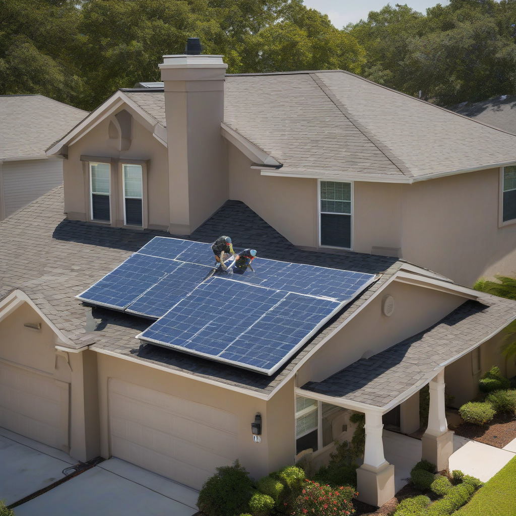
There’s a golf course in Clear Lake City that doesn’t exist anymore. The city converted it into a regional detention basin that captures stormwater before it reaches Horsepen Creek. The project is called Exploration Green. It’s complete, operational, and has already been tested by real storms. It’s one of the clearest before-and-after flood infrastructure stories Houston has produced since Harvey.
That’s the kind of evidence this article is built on. Not a Realtor’s impression that a neighborhood “drains well.” Not fresh paint on a flood-damaged house. Infrastructure. Designed, funded, built, and verifiable against actual insurance claim records.
Houston’s flood-risk conversation has improved since 2017, but it still tilts too heavily on vibes and anecdote. Buyers ask their agent whether a street floods. Sellers say they’ve “never had water in the house.” Insurance brokers quote a FEMA flood zone designation drawn from rainfall data collected before the city’s last thirty years of development. The 2018 Harris County flood bond passed with 85% of the vote, and the resulting $2.5 billion program is the most ambitious local drainage investment in the region’s history. Most residents can’t name a single project it has funded, let alone tell you whether their block benefits from one that’s finished.
That gap is what this piece is trying to close.
What the $2.5 Billion Bond Actually Bought — and What It Hasn’t Yet
Harris County voters approved the Flood Control District’s bond measure in November 2018. Eighty-five percent approval. That number tells you how badly Harvey rattled this city. The bond authorized $2.5 billion for 181 identified projects across the county’s major bayou watersheds.
Six-plus years later, the honest summary is this: the program is real, the money is being spent, and meaningful construction has been completed in several watersheds. But most of those 181 projects remain in some stage of planning, design, or early construction. “Funded” and “finished” are not the same word. For anyone making a near-term real estate or insurance decision, that distinction is everything.
The Harris County Flood Control District maintains a live project status map at hcfcd.org that shows each bond project’s current phase. This map is the single most useful tool a Houston buyer or owner has access to, and it’s almost never mentioned in flood-risk coverage.
One more distinction worth nailing down: HCFCD’s bond program is separate from two other major flood-infrastructure efforts affecting Harris County. The U.S. Army Corps of Engineers is conducting its own work on the Addicks and Barker reservoir systems — a federal project with its own timeline, funding, and legal complications from Harvey litigation. The City of Houston has separate obligations for neighborhood-scale drainage under its own capital program. All three efforts overlap geographically but are administered independently. When someone tells you “the county is fixing it,” push back: which entity, which project, what phase?
The Completed Projects, Named and Located
The following projects are either substantially complete or have major phases verified complete as of 2024–2025. These are the neighborhoods where flood resilience has measurably changed — not eliminated, but reduced.
Project Brays (Brays Bayou, Multiple Phases)
Brays Bayou runs from west Houston through Meyerland and Braeswood Place to the Texas Medical Center and beyond. The Army Corps and HCFCD have been widening and deepening the channel in phases for years, and the 2018 bond accelerated several segments. Upstream work through the Fondren Southwest and Gulfton corridors added meaningful conveyance capacity. Channel work through the Meyerland reach is substantially complete in several segments, with bank stabilization and improved geometry that increases how much water the channel can carry before it overbanks. Neighborhoods that have seen completed Brays work in or adjacent to their reach include Meyerland, Braeswood Place, Westbury (partially), and portions of Fondren Southwest.
Meyerland is also a more complicated story than that list implies. There’s a section below on what “improved” actually means there, and it’s worth reading before you take “substantially complete” as reassurance.
Exploration Green (Clear Lake City / Horsepen Creek Watershed)
The former golf course converted into a regional detention basin is the clearest before-and-after story available. The project is complete and has been stress-tested by real storms. Neighborhoods downstream along Horsepen Creek — Clear Lake City, portions of the El Dorado Boulevard corridor — are experiencing documented stormwater relief. Buyers in this area should ask specifically whether a Letter of Map Revision has been finalized for their parcel. Harris County Floodplain Management can answer that question directly for a specific address. More on that below.
White Oak Bayou Upstream Improvements
Bond-funded detention and channel work upstream of the Inner Loop has improved conveyance through the Independence Heights area and provided benefit to adjacent Woodland Heights reaches. White Oak was one of the most severely impacted watersheds in Harvey. The upstream detention work — including acquired land converted to detention storage — is completed and verifiable. The lower reaches of White Oak, closer to the confluence with Buffalo Bayou, remain more complex and subject to compound flooding during major events. That’s not a footnote. Any buyer near the lower reach needs to understand it upfront.
| Project | Bayou/Watershed | Primary Neighborhoods Affected | Status |
|---|---|---|---|
| Project Brays (upstream phases) | Brays Bayou | Meyerland, Braeswood Place, Fondren SW | Major phases complete; some segments ongoing |
| Exploration Green | Horsepen Creek | Clear Lake City | Complete |
| White Oak Upstream Detention | White Oak Bayou | Independence Heights, Woodland Heights adj. | Substantially complete |
This table covers completed or substantially complete work only. Use hcfcd.org to check projects not listed here.
The Insurance Data Behind the Claims
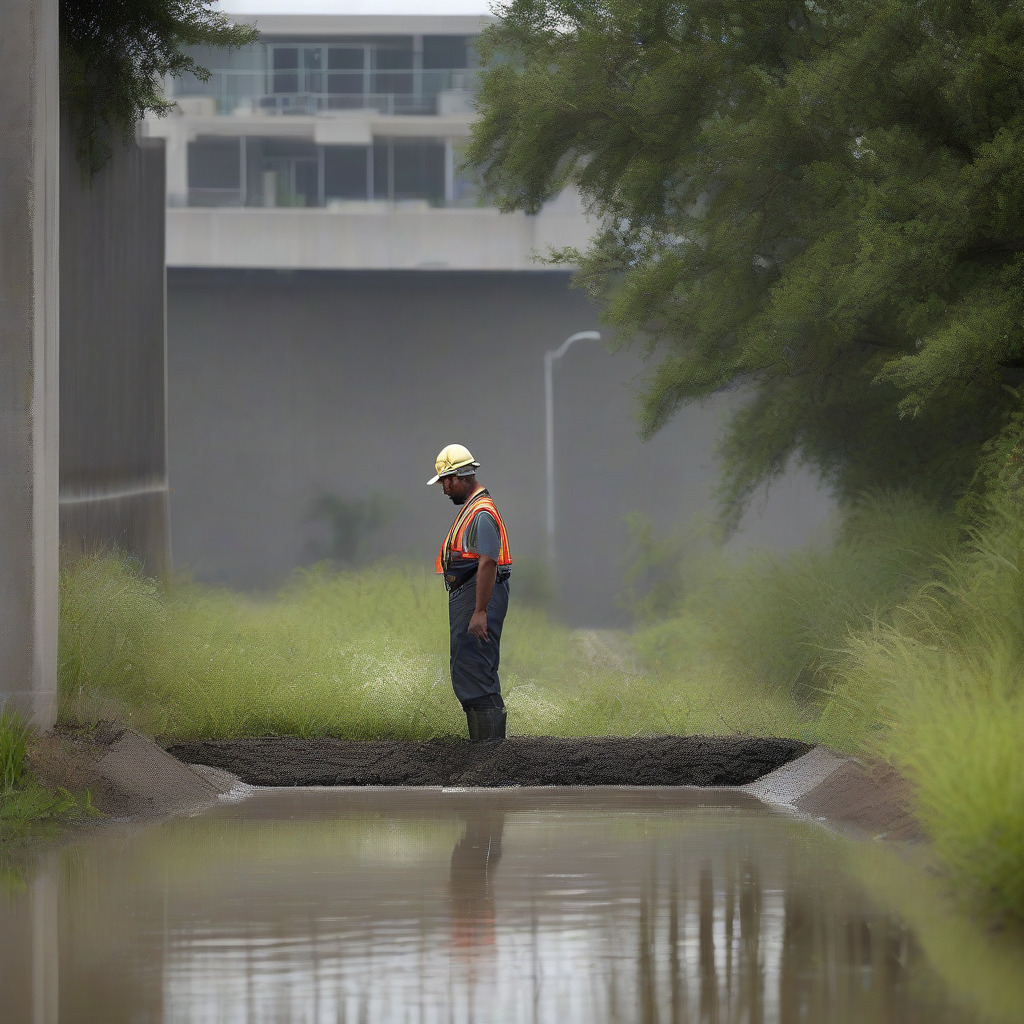
FEMA’s OpenFEMA dataset makes National Flood Insurance Program claims searchable by ZIP code, and the Harvey numbers are instructive. The heaviest NFIP claim concentrations in Harris County after Harvey cluster around the major bayou corridors. ZIP code 77096 — Meyerland and the surrounding area — carried one of the county’s highest claim densities. ZIP codes 77025 (Braeswood/Medical Center corridor), 77042 (Westheimer/Briargrove), and 77339/77345 (Kingwood) also rank among the highest. Kingwood’s flooding came primarily from the San Jacinto River, which is under Army Corps jurisdiction — a different funding stream than the Harris County bond, and an important distinction when evaluating what bond completion actually means for that community.
The most useful post-Harvey stress test available is Tropical Storm Imelda in September 2019. Historically severe rainfall, a new wave of NFIP claims. The problem: almost none of the 2018 bond projects had reached construction by the time Imelda arrived. They were still in design and environmental review. So Imelda claim data can’t be cleanly used to measure bond project effectiveness, and anyone who claims otherwise is overreaching.
What can be quantified is Harris County’s home buyout program. Since Harvey, the county has completed buyouts of more than 4,000 repetitive-loss structures — homes that had flooded multiple times whose owners accepted fair-market purchase offers. Those structures are gone. The lots are deed-restricted against future residential construction. That’s a permanent, verifiable reduction in flood-damage exposure that rarely gets counted in our home & property coverage, but it’s one of the most concrete things the county actually accomplished.
Still Waiting: Funded but Incomplete
Greenspoint, in the Little Cypress Creek area, has bond allocations but minimal completed construction. This is a community with a high proportion of renters and low-income residents who have limited capacity to self-insure against flood loss. Kashmere Gardens, in the Hunting Bayou watershed, has funded work that remains largely in planning and early design — and Hunting Bayou saw severe Harvey flooding in a part of the city that received comparatively little media coverage. That coverage gap matters, because it shapes which neighborhoods people assume are “fixed.”
Inwood Forest sits in the Cypress Creek corridor on Houston’s northwest side, a watershed with significant upstream development pressure and incomplete detention infrastructure. Bond allocations exist; substantial construction doesn’t yet. Westbury and portions of South Park and Sunnyside — communities in the Brays Bayou tributary system south and southwest of the Medical Center — have seen some upstream progress on the main stem but remain exposed through their tributary drainage networks. Those tributary networks are harder and more expensive to address. Nobody in those communities should be told otherwise.
The equity dimension here is straightforward: Harvey flooded properties across Harris County’s income spectrum, but recovery resources, buyout eligibility, and infrastructure priority did not flow uniformly. The bond program was a genuine attempt to correct historical underinvestment in communities like Kashmere Gardens and Sunnyside. The attempt is real. The construction crews haven’t arrived yet, and residents of those neighborhoods shouldn’t be told their risk has been addressed when it hasn’t. That’s not politics; it’s just what’s true on the ground.
The 2026 FEMA Remapping Wildcard
Harris County’s current Flood Insurance Rate Maps are, in significant portions of the county, built on rainfall data that’s decades out of date. FEMA and NOAA completed a major re-analysis called Atlas 14 that recalibrated what a “100-year storm” actually means for the Gulf Coast. Short version: Houston gets more rain, more intensely, than the old models assumed. The 100-year storm threshold went up significantly. If that sounds unsettling, it should.
FEMA is conducting a Harris County map modernization expected to incorporate Atlas 14 data and reflect post-Harvey topographic surveys. Two things will happen.
First, some addresses currently in lower-risk zones — X zones outside the Special Flood Hazard Area — may be pulled into the SFHA, triggering mandatory flood insurance requirements for federally backed mortgages and likely higher premiums. If you’re buying in a currently low-risk area without flood insurance, the map your purchase is based on may be superseded before your mortgage is paid off. That’s not hypothetical.
Second, addresses near completed detention projects may qualify for Letters of Map Revision that formally lower their flood zone designation, potentially reducing or eliminating mandatory purchase requirements and lowering premiums. Exploration Green’s downstream reach and certain Brays Bayou segments are candidates. A LOMR is a formal FEMA determination that a specific property is no longer within the SFHA, based on as-built project documentation. They’re not automatic — they require applications filed by the project sponsor, typically HCFCD. If you’re buying near a completed flood project, ask specifically whether HCFCD has filed or is planning to file a LOMR for that reach. Harris County’s Floodplain Management office can answer this question for a given parcel. Most buyers never call them. That’s a mistake.
Verify the current remapping timeline with FEMA Region 6 or Harris County Floodplain Management before making any decisions based on anticipated map changes. The scale of changes anticipated makes this a near-term material issue, not a distant abstraction.
How to Check Your Specific Address
Every tool listed here is free and publicly accessible.
HCFCD Project Viewer (hcfcd.org): The bond project map shows every funded project by location and current phase — planning, design, land acquisition, construction, or complete. If there’s a project near your property, note its phase. “Complete” means infrastructure is in the ground. “Design” means it could be years away.
FEMA Flood Map Service Center (msc.fema.gov): Enter your address to find your current Flood Insurance Rate Map panel and flood zone designation — AE (high risk, 1% annual chance), X (moderate to low risk), and so on. Check the effective date of the map panel. If it predates 2017, you’re looking at pre-Harvey data.
Harris County’s Know Your Flood Risk Portal: Available through the HCFCD website, this tool provides a layered view that includes not just FEMA zones but also local drainage context and Harvey inundation data. More detailed than the FEMA tool for Harris County-specific conditions.
First Street Foundation’s Flood Factor (floodfactor.com): Probabilistic modeling that estimates property-level flood risk across multiple storm scenarios and projects forward over climate trajectories. Useful for understanding directional risk over a 30-year mortgage horizon. Critical limitation: Flood Factor scores don’t govern insurance premiums. A lender will quote you based on your FEMA zone, not your Flood Factor score. Use First Street to understand risk; use FEMA maps to understand insurance cost.
OpenFEMA Historical NFIP Claims: Downloadable by ZIP code. Won’t tell you about an individual property’s claim history, but it tells you how many claims were filed in your ZIP code during Harvey and subsequent events. A ZIP code with hundreds of Harvey claims is telling you something that a flood zone designation alone doesn’t capture.
Call Harris County Floodplain Management directly. This is the step almost nobody takes, and it’s the most useful one. Staff can tell you whether a LOMR has been filed for your parcel or nearby area, whether the property sits near a completed bond project that has changed its drainage context, and whether the upcoming FEMA remapping is likely to affect your zone designation. Their contact information is at hcfcd.org. A phone call before a purchase offer can answer questions no website will answer precisely for a specific address.
What “Improved Flood Resilience” Does Not Mean
Meyerland is the most instructive case study here.
Brays Bayou channel work through the Meyerland reach is substantially complete in several segments. That work is real. It increased the bayou’s ability to move stormwater before it overbanks into residential streets. The home buyout program removed a number of the most-damaged, most-repetitive-loss structures from the neighborhood’s inventory. But Meyerland is a downstream community. The upstream improvements that benefit it most are those that detain or slow water before it reaches the neighborhood’s stretch of the channel. Whether that upstream capacity is sufficient depends entirely on the storm — specifically, where the heaviest rainfall falls relative to the detention infrastructure. A storm centered over southwest Houston that overwhelms Brays’ upstream capacity before the water ever reaches completed detention segments doesn’t deliver the same protection as one that hits the upper watershed and is captured there. That’s not a flaw in the project. It’s the nature of flood infrastructure.
The right word for Meyerland — and honestly for every Houston neighborhood that has received meaningful flood investment — is resilient, not flood-proof. A more resilient neighborhood absorbs a given storm with less damage than it would have taken before the infrastructure existed. It doesn’t mean a sufficiently large or poorly positioned storm can’t still cause flooding. No neighborhood in Harris County is flood-proof. None.
The Addicks and Barker reservoir situation deserves specific mention for anyone considering property in the Energy Corridor, Cinco Ranch, or the Barker area. The federal government has made operational changes to the reservoirs following Harvey litigation, and the Army Corps has authorized structural improvements. But the downstream risk picture remains genuinely complex, and the authorized structural work is on its own federal timeline. A buyer in that corridor needs to research which improvements are complete, which are authorized but not yet funded, and what operational rules govern future events — at the Army Corps level, not the county level. A general assurance that “they fixed the reservoirs” is not due diligence before a several-hundred-thousand-dollar purchase.
Some Houston neighborhoods carry meaningfully less flood risk today than they did the week before Harvey. Others are still waiting for construction that’s been promised but not delivered. The FEMA maps that currently govern insurance costs in this county are about to change in ways that will affect buyers and owners across every risk category. The evidence is publicly available, mostly free, and more specific than anything a Realtor or insurance broker will volunteer. Use it before you sign anything.
Editor’s verification flags: Confirm HCFCD bond project completion count as of publication date using hcfcd.org project status map; verify specific Brays Bayou phase completion designations with HCFCD public affairs; confirm Harris County floodplain portal current URL; confirm Exploration Green LOMR filing and approval status; verify FEMA Harris County remapping timeline with FEMA Region 6 or Harris County Floodplain Management; confirm Bear Creek detention project completion status before reinstating in table.